Monday, August 27, 2007

Inca Trail, Peru.

On the trail


The tour didn't start off too well. We had hired sleeping bags. They arrived at our hotel the night before we left. What a disappointment. "1.7kg, down bags" we were promised... 2.4kg, synthetic, stinky bags were what we got. The 700g may seem petty, but when you're carrying all your own gear at altitude, 100g can make all the difference let alone 700g of stinking synthetic sleeping bag. Thankfully I had brought my sleeping bag that I'd bought in australia. It probably wasn't as warm, but it didn't smell... that was my priority! Reena was stuck with hers... poor thing. (I managed to get a refund at the end - yay!).

We were picked up the next morning at 06:00, although we were told to be ready by 05:20. Images of our experiences in Halong Bay were starting to pop up again. Please, not again. But... from the moment we got on the bus everything started taking a positive turn.

Runkuracay - 3800m


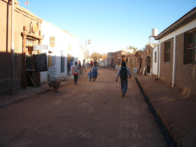
After a four hour bus journey including breakfast at Ollantytambo (and a small show involving 20 Peruvian boys pushing a bus back onto the road after it drove off the track onto a roof), we arrived at km 82. We got our passports stamped and set off on the trail. I took the first hill a little too fast. I should have known better after our trek in Nepal. Oh well, I learnt my lesson atleast. I set myself a better pace for the rest of the day. Tiring, but no dizziness. Great!

Reena and I


The path was pretty well worn. We stopped numerous times on the way to learn about different plants and parasites. It was hot! I was not expecting it to be that warm. It was almost desert like with the hot dusty trails in the mountains. The first ruin was Patallacta. We stopped higher up on a neighbouring mountainside to view it from above. Pretty impressive.

Patallacta


We arrived at the camp site after about four hours or walking. The tents were already up! We had so many porters for our group - 20, including the cook. Crazy, but I was so impressed with the quality of food and service. Five course meals at dinnertime!

Our porters


There were 16 of us in our hiking group:
-Reena and I,
-Susie and Simon (a British couple),
-Sylvia, Jenny, Tammy and Christine (four Pharmacy students from CA),
-Will, Ash and Nick (three British boys just graduated as engineers),
-Jim, Kibbie, Christine and Carrie Anne (a family also from CA,
-Tally (a hippyish kinda kid from Hawaii).

Our guides:
-Bobby and Willy (he insisted his name was "willy"... ok.)

Our group at the top of the first pass


Every morning we were woken up in our tents with a cup of tea! I loved it! Although the porters on this trek seemed to do a lot more for us that we had experienced elsewhere, they were also looked after better themselves. They had restrictions on what they could carry for tourists, 24kg on the first day, 22kg on the second. In Nepal, the porters would carry anything up to and even exceeding 40kg.

The tea came to our tents when it was still dark. Not fun getting up in the cold and darkness, but the sunrises made it worth it.


Walking in the mist.


The second day was the toughest by far. Reena and I wanted to walk with our full backpacks. We woke up that morning at 3000m. Our target that day was the highest pass at 4200m. We started off so well... then we hit the second break at 3800m. A quick trip to the loo revealed I hadn't escaped that "once a month inconvenience" - bang on time it was. urghhh... I feel weak and dizzy at the best of times. Add a 10kg backpack, a big hill, the sorching sun and the altitude -I wasn't having fun! I fought back the tears that day, but we made it to the top! We found the rest of our group waiting for us (except two others), well... Reena and I were the only ones who decided to carry our own bags. We were allowed to be at the back!

At the top of Dead Woman's Pass - 4200m


Nick at the top of the second pass - to show there were blue skies at the start of the trek!


I survived the altitude so much better than in Nepal. A few in the group had headaches, but nothing more serious. We played a few little games like the alphabet game to get us through the day, in the evenings we played cards and a dice game I learnt in New Zealand. I love the dice game... you quickly learn what kind of person a player is like when you play this game! It reveals all... ha!

Terraces of Intipata. These terraces are not for agriculture, but to protect the mountainside site from erosion.


We visited many ruins along the way. I'm surprised how much the Inca's knew about building to protect themselves against earthquakes. They would build their walls at all sorts of different angles. Truely amazing, because these walls have been standing for hundreds of years, yet the homes and buildings in Pisco and Ica, which were hit by earthquake in August, suffered pretty bad. The Peruvian's should make the most of this 'ancient' technology. Its been tried and tested. Use it! Granted its probably more expensive and takes longer to build, but you cant put a price on life. Well the Japanese seem to think its worth it. Apparently they are incoperating the Incan ideas into their architecture now.

A sacred wall in Machu Picchu. This wall is just stone on stone... no mortar or cement. And its still standing despite centuries of earthquakes!


Bobby - our head guide


The last couple of days gave us cloudy skies. We missed a lot of the views due to the mist, but it just added another element to the trek. It kept us cool too! We also had to sort out the tips for the guides and porters on the last night. What confusion that was... we had to create 22 different piles of money. Not easy when you dont have access to a change machine.

In Sayacmarca - 3600m


Tally and Will in Sayacmarca


Day 4: The last day of the trek which leads you to Machu Picchu. Early start... 03:45. We raced to get ready and down to the gates. The campsite contained quite a few groups who were heading to Machu Picchu that day. Our aim was to be the first to get there... Well we were the second group to the gates. That was ok. Once we got through the gate, it was each to their own... The trail of people infront of me stormed off, and the trail of people behind me disappeared into the darkness. Oh no... I was on my own in the dark. It was so scary! I thought I'd taken a wrong trail somewhere and would be lost in the jungle forever, or I'd be kidnapped by this unknown Inca Tribe and sacrificed to their Gods. It didn't help either that their was this creature with a 'glow in the dark' head that was following me! I was later told that it was an owl... After a tortuous 25 minute walk in the dark mist I finally stumbled on Tally. I was sooo happy to see him, although he too had a tendency to wander off into nowhere. Atleast I wasn't on my own anymore!

An Incan tunnel


We got to the sungate. You're supposed to be able to see Machu Picchu from here. Every so often the clouds would part and give you a sneak preview. I just wanted to get down there!

Machu Picchu


We got down to the site and Bobby gave us a two hour tour in the cold and rain. It was pretty good, but the site is not a touch on the ruins in Cambodia. I only wish we had a tour guide for Angkor Wat now. We learnt loads though from our tour. It is an amazing site, although it has a slightly manicured feel to it. I prefer sites that still look like they're ruins that have just been stumbled across. I guess thats a difficult look to achieve when you have 3000 tourists a day to manage. We had a last dinner with out group in Aguas Calientis, then headed back to Cusco by train and bus.


Here's to you Ash for surviving the Inca Trail with D&V!

Sunday, August 19, 2007

San Pedro de Atacama, Chile.


South America takes it's bus travel really seriously. Its like checking in at the airport, checking in your baggage, showing your passport, being recorded on video (anyone know what thats about?!), being allocated a specific seat with pillows and blanket, being fed all meals, served by your own 'in flight' attendant! Its great!


After 24 hours on the bus, watching English movies, dubbed over in Spanish, with English subtitles, we arrived in San Pedro De Atacama in Northern Chile. The scenery from the bus was mostly desert. I didn't realise how much desert there was in Chile... I imagined it all to be mountainous. Nope. Sand, more sand, and dodgy looking chemical plants. When we arrived at the bus station in San Pedro we were approached by a few touts, but nothing like in Siem Reap... these Chilean's were much more chilled out. Lovely.


We took a stroll through the town to find some food. It reminded me of the wild west movies set in Mexico. Dirt and Dust blowing everywhere. Walls seemed to be made of mud and straw, some whitewashed over. It was such a relaxed town. We didn't speak any Spanish... so we had to rely on making random orders on menus. I ended up with a chicken leg and reena a veggie omelette. Not a bad start. The town was well catered for tourists too - a souvenier market, streets were lined with guesthouses, tour offices and cafes, yet life still seemed to be going as a slow crawl here.


This is the Main Square at its busiest!

Our original plan was to head into Southern Bolivia from here, spend a week or so in Bolivia to make it to Cusco for the start of the Inca Trail. Well... due to a small amount of bad admin, we suddenly realised we had to be in Cusco in three days! The mammoth bus journey was about to start. We checked out of our hotel that morning and went and sat in the main square waiting for our bus to depart that evening...


Reena with all our gear.

Friday, August 17, 2007

Santiago, Chile.

If you're going to South America and you think you'll need a travel guide, make sure you buy it before you go - unless you can speak Spanish. Buying an English copy of the Lonely Planet out there cost an arm and a leg. £40!!! We decided to get around by trying to ask questions in English to people who had no idea how to speak English! Thankfully the people of Chile are amazingly friendly and will try all they can to help you out, even when they dont have a clue what you're saying!

The Municipalidad de Santiago. The site where the Spanish first set up a fort.


A view over Santiago.


Unfortunately we weren't able to see much of the snow capped mountains that surround the city. Santiago gets pretty smoggy.


Santiago, though a bustling capital city, wasn't much of a tourist spot. There wasn't too much that jumped out at us to see so we headed straight up to San Pedro de Atacama in the north.

Tuesday, August 14, 2007

Mount Maunganui, New Zealand.


Mount Mauganui


From Rotorua we headed to Mt. Maunganui, a trendy little town, full of cool bars and cafes, and a great beach. We made the climb to the summit of the extinct volcano. It was a really clear sunny day, giving us great views over the town and ocean. We just relaxed here, played minature golf and even made some rock sculptures. I could have stayed here longer but time was short and we left for Auckland the following day.

This isn't my photo (I found in on google), but its a great shot showing the extinct volcano connected to the mainland by a sandbar, which has been built on creating the suburb of Tauranga known as 'Mount Maunganui'.


Walking up Mount Maunganui. Its covered in sheep!


At the summit. You can see the shadow of the Mount in the foreground of the photo.


Chilling at the top. Great View!


Leaving my mark on Mount Maunganui. The first time I saw these were in Stanley Park, Vancouver. The rocks here weren't as great for the sculptures, but we still had fun!


The harbour.


Sunset at Mount Maunganui.

Monday, August 13, 2007

Rotorua, New Zealand.

This was the third time I had landed in Rotorua but I really loved the place, despite the smell!

Wai-O-Tapu mud pools. I missed these on previous visits, so I made sure I went to see them this time round. An amazing sight!

Te Wairoa Village - The burried village.

Mount Tarawera erupted in 1886. Te Wairoa, a little village closeby was burried in mud, rock and ash, killing 150 people. We visited the site. The museum was pretty interesting, but the village walkthrough was a bit of a let down! I think I was expecting too much, particularly having already seen pompei.

Below are some of the Maori wood carvings that can be seen in Rotorua....


Saturday, August 11, 2007

Taupo, New Zealand.


Taupo

Taupo is located on the northeastern shore of Lake Taupo, the largest lake in New Zealand. To get there we took a drive through the Tongeriro National Park, the fourth national park to be established in the world. It contains the North Island Volcanic Plateau - three volcanoes and the lava fields surrounding them. One of the volcanoes, Mount Ngauruhoe, was used for 'Mount Doom' in the Lord of the Rings movies, but even driving past it on three different occasions I was never able to get a decent photo because of the low cloud :(

Mount Ruapehu - you're able to ski on this volcano!

Lava fields. There were such strong winds blowing across this area. It was difficult to keep the van on a straight path along the roads!


Lake Taupo - looks like heaven opening up!


In Taupo we went on a short walk to the Huka Falls located on the Waikato River. The flow of water through this chasm in the rock is so powerful that the Kiwi's decided to harness this power, so a hydroelectric plant was set up nearby. These falls now supply the north island with 65% of its energy demand. Pretty impressive!


Huka Falls


New Zealanders also try to obtain power from geothermal activity. A geothermal power station was built nearby. This caused an increase in geothermal activity in the surrounding area producing steam vents, craters and bubbling mud pools. The area is now known as 'Craters of the Moon'.
Me at 'Craters of the Moon'.


Looks like a battlefield...

Thursday, August 09, 2007

New Plymouth, New Zealand.

New Plymouth


It is believed that New Plymouth was formed when a volcano erupted and raised the level of the surrounding land. You can see from the map above, a round bump on the west coast that starts where New Plymouth is. In the centre of that bump is Mount Taranaki. Unfortunately the weather didn`t bring us clear blue skies so the peak was always obscured by cloud, but you cant have it all!

The area has great fertile soil due to previous volcanic eruptions, and so New Plymouth and the surrounding towns are famous for their gardens. Due to the time of year there wasn´t much in a few of these gardens except brown soil and dying flowers but we still went to see.

Tupare Garden - great water feature.


The city park was by far the best grounds that we saw. Lush lawns, wild woods, winding paths, numerous lakes with japanese style bridges. Lovely!

A japanese looking bridge. Apparently the guy who designed this bridge (in the 1800s), was found a few years later drowned right by it. They reckon he commited suicide.


New Zealand has so many ferns. They´re in every forest and wood. It feels like you´re walking through the movie Jurassic Park!


Thats me inside that pagoda...


Here´s a Chinese Garden - apparently New Plymouth has a sister city in China, Kunming.


This is the ceiling of the chinese pagoda you can see through the archway above.


Its so weird to see in August, but the daffodils are just coming out!


Very rarely do you see old buildings in New Zealand. The Brooklands Park has a famous chimney. It once belonged to an old wooden house that was built in the mid 1800´s (the land used to belong to this house, which was later offered as the city park). The house was burnt down in a Maori battle, all that remains is the stone chimney.

Me inside the fireplace!


We had hired bikes for the day, cycling down the coastal path, then detouring to all the different gardens and parks. The day was finished off with a lovely sunset!

Sunset in New Plymouth.